Guides

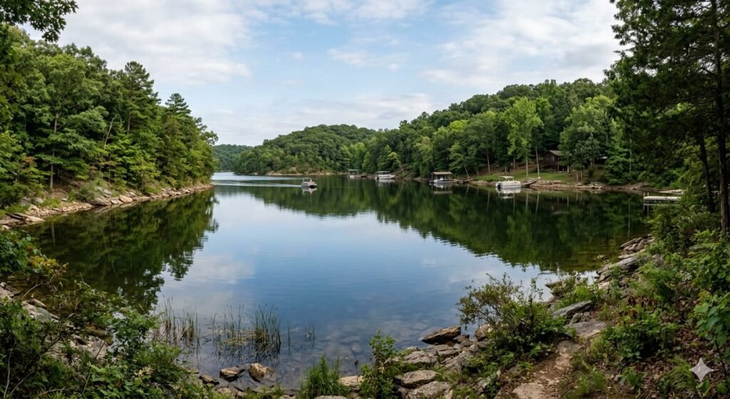
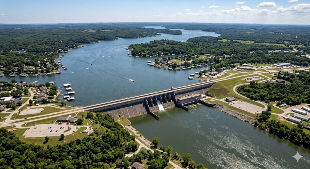
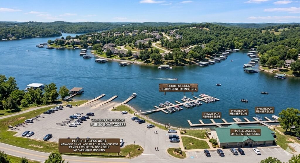
Public dock access near Village of Four Seasons at Lake of the Ozarks Missouri
Guides

How to Find Public Docks Near Village of Four Seasons at Lake of the Ozarks

Village of Four Seasons is a quiet, well-established community on Lake of the Ozarks. It sits along the mid-lake region of the Osage Arm. Many visitors rent vacation homes here. Families come back every summer. The community is peaceful, residential, and close to everything the lake has to offer. But one question comes up again and again. Where do you actually get on the water? Especially if your vacation rental does not have a private dock. Or if you are meeting a yacht charter and need a public boarding point nearby. This guide answers that question completely. We cover public docks, boat ramps, marina access, and everything else you need to know about getting on the water near Village of Four Seasons. Understanding the Village of Four Seasons Area on the Lake Village of Four Seasons is located in Camden County, Missouri. It sits roughly in the mid-lake region near mile marker 25 to 35 on the Lake of the Ozarks main channel and lower Osage Arm. The community is primarily residential. There are private docks lining much of the shoreline here. This is important to understand. Most of the waterfront access in Village of Four Seasons itself is private. Homeowners and vacation rental guests use private docks that belong to specific properties. If your rental has a dock, that is your easiest access point. But if it does not, you need to know where the public options are nearby. The good news is that the area surrounding Village of Four Seasons has several solid public access points. You do not need to travel far to find a boat ramp, a public dock, or a full-service marina. The key is knowing which options exist and how to reach them efficiently. Understanding the layout of the lake in this zone also helps. The main channel runs close to the Village of Four Seasons area. This means you are not far from the most navigable and well-served part of the lake. Marinas and public landings in this region are set up to handle boaters of all kinds, from small fishing boats to large luxury yacht charters. Public Boat Ramps and Launch Points Near Village of Four Seasons The most accessible public option for many boaters near Village of Four Seasons is the Missouri Department of Conservation and Missouri State Parks system of public boat ramps. These ramps are maintained by the state and are open to all boaters. Most charge a small daily fee or accept a Missouri fishing license as access. The Hwy 54 Boat Ramp area near Osage Beach provides one of the more convenient public launch options for boaters in this region. Osage Beach is just a short drive from Village of Four Seasons. This area has multiple launch facilities. Ramps here are wide, well-maintained, and capable of handling larger trailers and bigger vessels. Camden County also maintains several public access points along the lake. These county-managed ramps are scattered throughout the lake region. Some have courtesy docks attached, meaning you can briefly tie up your vessel while loading or unloading passengers and gear. These courtesy docks are not designed for overnight or extended stays, but they are very useful for day-use boarding. The Lake of the Ozarks State Park boat access is another option worth knowing about. The state park is located in the lower portion of the lake but is within reasonable driving distance from Village of Four Seasons. The park has a public boat ramp with access to the main channel. If you are launching a personal boat, this is one of the better-maintained facilities in the region. When planning to use any public ramp near Village of Four Seasons, arrive early on summer weekends. Ramps get busy fast. Lines can form quickly on Saturday and Sunday mornings during peak season. Weekday access is much smoother. Most ramps open at sunrise and have adequate parking for vehicles with trailers. Marinas Near Village of Four Seasons and What They Offer Beyond public boat ramps, the area near Village of Four Seasons has several full-service marinas. These marinas offer more than just a place to launch. Many provide fuel, pump-out stations, boat rentals, slip rentals, and temporary guest docking. For charter guests who need a convenient boarding point, marinas are often the best option. Marinas in the Osage Beach and Lake Ozark corridor near mile marker 15 to 28 are the closest full-service options to Village of Four Seasons. This stretch of the lake has one of the highest concentrations of marinas anywhere on the water. Most of these facilities have transient slips available. A transient slip is a temporary docking space that any boater can rent by the hour or day without a long-term commitment. When you call a marina to ask about transient dock access, a few questions are worth asking. First, confirm they have space available for the size of vessel you are boarding. A 50-foot luxury yacht needs a slip that can accommodate its length and beam. Not all marinas have large enough slips. Second, ask about the fee structure. Some marinas charge by the foot per night or hour. Others have flat day-use rates. Third, ask whether the dock has easy access from the parking area. Carrying coolers, bags, and gear across a long floating dock can be challenging without proper setup. Several marinas in this region also offer courtesy docking for charter guests. This means you can tie up at their dock briefly to board a charter vessel without paying a full slip fee. Charter companies that operate regularly in this area typically have arrangements with nearby marinas. When you book a yacht charter at Lake of the Ozarks through Yacht Rental Lake Ozark, ask about the closest boarding marina to your Village of Four Seasons location. They can recommend the most convenient option for your specific rental address. How to Reach Public Docks From Village of Four Seasons by Road Getting to public docks and marinas from Village of Four
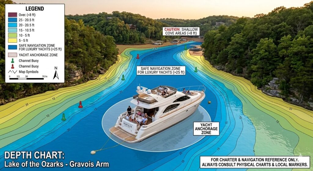
Depth chart of Lake of the Ozarks showing safe navigation zones for luxury yachts
Guides

Water Depth Requirements for Major Luxury Yachts at Lake of the Ozarks

One of the most common questions guests ask before booking a luxury yacht charter at Lake of the Ozarks is about water depth. It is a smart question. A large yacht is not like a small fishing boat. It sits deeper in the water. It has specific clearance requirements. It cannot go everywhere on the lake safely. Understanding water depth requirements helps you plan a better charter. It helps you understand why your captain makes certain routing decisions. It also gives you confidence that your vessel is always in safe, appropriate water throughout your trip. This guide covers everything you need to know. We explain what draft means, how deep the lake actually is, which areas are safe for large yachts, and how experienced captains navigate Lake of the Ozarks with precision and safety. What Is Draft and Why Does It Matter for Luxury Yachts Before talking about depth, you need to understand draft. Draft is the measurement of how far a vessel extends below the waterline. It is the distance between the surface of the water and the lowest point of the boat’s hull. A small pontoon boat might have a draft of just one to two feet. A mid-size cabin cruiser typically has a draft of two to three feet. A major luxury yacht in the 45 to 65-foot range often has a draft of three to five feet. Some larger vessels go deeper than that. The draft determines the minimum water depth the vessel needs to float and move safely. If the water depth is less than the vessel’s draft, the boat will run aground. Running aground means the hull hits the bottom. This can cause serious damage to the vessel. It can also create a safety risk for everyone on board. This is why draft is one of the most important specifications for any yacht operating on an inland lake. At Lake of the Ozarks, the water depth varies enormously from one area to another. The main channel near Bagnell Dam reaches depths of over 100 feet in some spots. But move toward a shallow cove or upper arm, and the depth can drop to just three or four feet near the shoreline. Knowing the difference between these areas is essential for safe luxury yacht navigation. How Deep Is Lake of the Ozarks in Different Areas Lake of the Ozarks has a very wide range of depths. This is partly because it was created by flooding a river valley. River valleys are naturally deep in the center and shallower along the sides and upstream reaches. The deepest water is near Bagnell Dam at mile marker 0. The lake can reach depths of 100 feet or more in this zone. This area is excellent for large vessel navigation. There is no risk of grounding in the main channel near the dam. The water is consistently deep and well-charted. From mile marker 0 to approximately mile marker 30, the main channel stays deep. Average depths in this zone range from 40 to 80 feet in the center. This is the most commercially active stretch of the lake. Marinas, boat docks, and waterfront businesses line both shores. The deep main channel makes it accessible to larger vessels throughout the season. Between mile marker 30 and mile marker 60, the average depth begins to decrease gradually. The channel is still navigable for luxury yachts in most areas. Depths in the main channel typically range from 20 to 50 feet. However, as you move off the channel toward coves and secondary inlets, the depth drops more quickly. Careful navigation is required when deviating from the main channel in this stretch. Above mile marker 60 in the upper lake and upper arms, depth becomes more variable. The main channel may still hold 15 to 30 feet of water. But coves and side channels can become quite shallow very quickly. Some upper-arm inlets have depths of only four to six feet even in their center sections. This limits which vessels can safely access these areas. The Niangua Arm and Osage Arm have their own depth profiles. The upper portions of both arms tend to be shallower than the main body of the lake. Experienced captains who regularly navigate these areas know where the deep pockets are and where the bottom rises unexpectedly. Draft Requirements for Common Luxury Yacht Sizes Different yacht sizes have different draft requirements. Understanding these numbers helps you appreciate the level of planning your captain puts into every charter route. A 40 to 45-foot luxury yacht typically has a draft of approximately 3 to 3.5 feet. This vessel needs a minimum water depth of around 4 to 5 feet to operate safely, leaving adequate clearance below the keel. This size can access most of the main channel and many coves throughout the lake with proper navigation. A 50-foot luxury yacht generally has a draft of 3.5 to 4.5 feet. This is one of the most popular sizes for group charters at Lake of the Ozarks. It needs a consistent minimum depth of 5 to 6 feet in the areas it navigates. The main channel and the lower to mid-lake zones accommodate this vessel size very comfortably. Some upper coves may be off-limits depending on seasonal water levels. A 60 to 65-foot yacht carries a deeper draft. These vessels typically require 5 to 7 feet of water minimum, and some may need even more depending on their hull design. At this size, the vessel is limited to the deeper sections of the lake. The main channel from the dam up through the mid-lake region is accessible. Remote upper arms and narrow coves are generally not suitable for a vessel of this size. It is also important to note that water levels at Lake of the Ozarks fluctuate seasonally. The Army Corps of Engineers and Ameren Missouri manage the lake’s water level. In summer, the lake is typically held at or near full pool. In winter and early spring, levels may

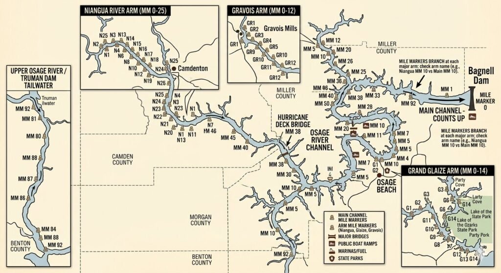
Detailed map of Lake of the Ozarks showing mile markers from Bagnell Dam to the upper arms
Guides

How to Read Lake of the Ozarks Maps for Private Charters

Planning a private charter at Lake of the Ozarks is exciting. But many guests arrive without a clear picture of how the lake is laid out. They hear terms like mile markers, arms, coves, and channels. They see a long, winding map that looks nothing like a typical lake. It can feel confusing at first. The good news is that Lake of the Ozarks has a very logical system. Once you understand the basics, the map makes complete sense. You can plan your route, identify your favorite stops, and communicate clearly with your captain before your charter even begins. This guide breaks it all down. We will cover the mile marker system, the main channel, the major arms, cove navigation, depth charts, and no-wake zones. By the end, you will know exactly how to read a Lake of the Ozarks map for your private charter. Understanding the Shape and Layout of Lake of the Ozarks Lake of the Ozarks is not a round or oval lake. It is a long, branching reservoir. It was created in 1931 when the Bagnell Dam was built across the Osage River. The dam blocked the river and flooded the surrounding valleys. This created a lake with one main channel and dozens of smaller arms, coves, and inlets branching off in every direction. The lake stretches over 90 miles from Bagnell Dam at the eastern end to the upper reaches near the dam’s headwaters. If you add up all the shoreline, the lake has over 1,150 miles of coastline. That is more shoreline than the entire state of California’s Pacific Coast. The sheer size of the lake is one reason a map is so important. When you look at a Lake of the Ozarks map, the first thing you notice is that the lake has a distinct shape. The main body runs diagonally from the dam area toward the northwest. Off this main body, two major arms extend in different directions. The Osage Arm runs to the northwest and is the longer of the two primary branches. The Niangua Arm branches off toward the west. Both arms have their own smaller coves and channels running off them. Understanding this branching structure is the foundation of reading any Lake of the Ozarks map. Everything else, including mile markers, cove names, and anchorage spots, is built on top of this basic layout. The Mile Marker System Explained The mile marker system is the single most important thing to understand when reading a Lake of the Ozarks map. It is the universal reference system used by boaters, marinas, captains, and local businesses across the entire lake. Mile markers start at zero. Mile marker 0 is located at Bagnell Dam. From there, the numbers increase as you travel up the lake away from the dam. Mile marker 1 is one mile from the dam. Mile marker 10 is ten miles up the lake. The mile markers continue all the way to the upper reaches of the lake near mile marker 92 on the main Osage channel. The Niangua Arm has its own set of mile markers. They branch off from the main channel around mile marker 28. The Niangua markers start at the junction and increase as you travel further into that arm. When a captain or marina mentions a location, they almost always use the mile marker as a reference point. “We are anchoring near mile marker 45” tells everyone on board exactly where the boat is on the lake. The lower portion of the lake, from the dam to around mile marker 20, is the most commercially developed stretch. Marinas, restaurants, bars, and resorts line both shores in this area. This is where you find Party Cove near mile marker 5, Shady Gators, Backwater Jacks, and many other well-known destinations. It is also the busiest and most congested stretch of water on the lake. As you move further up the lake past mile marker 30, the development thins out. By mile marker 50 and beyond, the shoreline becomes more wooded and residential. Traffic drops noticeably. The water gets calmer. Many guests who want a peaceful, relaxing private charter experience prefer the middle and upper sections of the lake for exactly this reason. Reading Coves and Arms on the Map Coves are the smaller inlets that branch off the main channel and the major arms. They appear on the map as narrowing pockets of water cutting into the shoreline. Some coves are wide and open. Others are narrow and deep. Understanding how to identify and read coves on the map helps you plan where to stop, swim, or anchor during your charter. Each cove has a name on most detailed Lake of the Ozarks maps. Some names are official. Others are local nicknames used by longtime boaters. Lynch Hollow, Gravois Arm, Hurricane Deck area coves, and Coffman Cove are examples of named locations that appear on most charts. Knowing the name of a cove makes it much easier to plan your route with your captain in advance. When reading a cove on the map, pay attention to its entrance width. A wide entrance means boats of all sizes can enter easily. A narrow entrance means only smaller vessels or careful captains can navigate inside. For a 50-foot luxury yacht, your captain will always check the entrance width before heading into any cove. Most maps mark shallow areas with dotted lines or color shading. The Gravois Arm is one of the most popular destinations for charter guests who want calm water and beautiful scenery. It branches off the main channel around mile marker 55 to 60 and runs for several miles to the southwest. The coves inside the Gravois Arm are well-protected and lightly trafficked. On a detailed map, you can see how the arm narrows as it extends further from the main channel. This narrowing is a visual clue that the water will be calmer and quieter the further in you go. The Upper Osage Arm begins

Glassy calm water on Lake of the Ozarks early morning with no boat traffic
Guides

Where Is the Quietest Water in Lake of the Ozarks?

Lake of the Ozarks is one of Missouri’s most popular lakes. It draws thousands of visitors every summer. Most people come for the party, the noise, and the excitement. But not everyone wants that. Some guests want calm water. They want peace, shade, a gentle breeze, and a quiet place to relax on a luxury yacht. If you are planning a yacht rental at Lake of the Ozarks, this guide is for you. We will show you exactly where to find the quietest water on the lake. We will cover the best coves, the upper arms, the no-wake zones, and the hidden spots that most tourists never find. Why Some Parts of Lake Ozark Are Much Calmer Than Others Lake of the Ozarks is a long, winding lake. It stretches over 90 miles from end to end. The shape of the lake plays a huge role in water conditions. The main channel runs through the center of the lake. This is where most of the boat traffic flows. It is the busiest and roughest stretch of water, especially on weekends. The lake branches off into dozens of coves and arms. These branches come off the main channel at different angles. When you move away from the main channel, the water becomes calmer. Boat traffic drops. Wake from passing vessels fades quickly. The deeper into a cove you go, the quieter it gets. Wind is another factor. The main channel is exposed to open wind from multiple directions. Coves are naturally sheltered. The shoreline, trees, and hills around a cove block the wind. This keeps the surface smooth and flat. On a windy day, the difference between the main channel and a sheltered cove is dramatic. The channel can have two-foot waves while a cove nearby stays completely flat. Water depth also matters. Shallower areas near public beaches and marinas tend to have more traffic and choppier conditions. Deeper, tucked-away pockets of water are naturally less visited. They stay quiet throughout the day, even on the busiest summer weekends. The Quietest Areas on Lake of the Ozarks The Upper Osage Arm is one of the most peaceful stretches of the entire lake. It sits in the upper portion of the lake, far from the tourist-heavy areas near the 1 to 10 mile markers. Traffic here is much lighter. The water moves slowly. There are long stretches of undisturbed shoreline with trees growing right down to the water’s edge. Families who want a calm, relaxing day on a chartered yacht often request this area specifically. The upper arm also has a number of small coves branching off to the left and right. These coves are often completely empty. You can drop anchor inside one and spend hours without seeing another boat. The scenery is beautiful. The hills around the upper arm are heavily wooded, and the water reflects the green of the trees. Lynch Hollow is another excellent choice for quiet water. This cove is tucked away from the main channel. It is deep enough to anchor a large vessel comfortably. The surrounding land is mostly private, which means fewer people use the area for swimming or recreation. When you are anchored in Lynch Hollow, the noise from the rest of the lake seems very far away. It is one of the best spots for a peaceful afternoon on the water. Hurricane Deck area sits in the upper portion of the lake around mile marker 100. The coves near Hurricane Deck are wide, calm, and lightly trafficked. The water here is clear. The depth drops off nicely near the cove walls. Many yacht captains recommend this area for guests who want to swim, relax, or simply enjoy the scenery without the chaos of the lower lake. The Gravois Arm is another well-known stretch of calm water. It branches off the main channel and runs for several miles. During weekday mornings, it can feel completely empty. Even on weekends, traffic is much lighter here than near Party Cove or Bagnell Dam. The Gravois Arm has beautiful coves running off both sides. You can anchor inside one and enjoy total privacy for as long as you like. Climax Springs area coves sit in the upper portion of the lake near mile marker 120 and beyond. This is some of the most remote and untouched water on the entire lake. Boat traffic here is extremely light. If you want the absolute quietest experience on Lake of the Ozarks, heading toward Climax Springs in the upper reaches of the lake is the best option. The water is glassy calm most mornings. Wildlife is common along the shoreline. Herons, eagles, and deer are frequently spotted in this part of the lake. No-Wake Zones and Sheltered Coves No-wake zones are designated areas of the lake where boats must slow down. Vessels are not allowed to create large wakes. These zones are usually found near marinas, boat ramps, and congested docking areas. However, many smaller coves also function as natural no-wake zones simply because of their shape. When a cove narrows at its entrance, large boats cannot enter at speed. They have to slow down to navigate the mouth of the cove safely. This means the water inside stays calm. Even if a boat does pass by outside, the narrow entrance absorbs most of the wake energy before it reaches the interior of the cove. A good captain knows which coves have narrow entrances and which ones are open to wave action. When you book a captained yacht charter at Lake of the Ozarks, your captain can steer you directly to the right spot based on the time of day, wind direction, and current traffic patterns. This local knowledge makes a real difference. The water near Laurie on the west side of the lake also tends to stay calmer. This area sits away from the main tourist zones. Fewer rentals and day boats operate here. The coves near Laurie are well-protected and easy to access by a larger

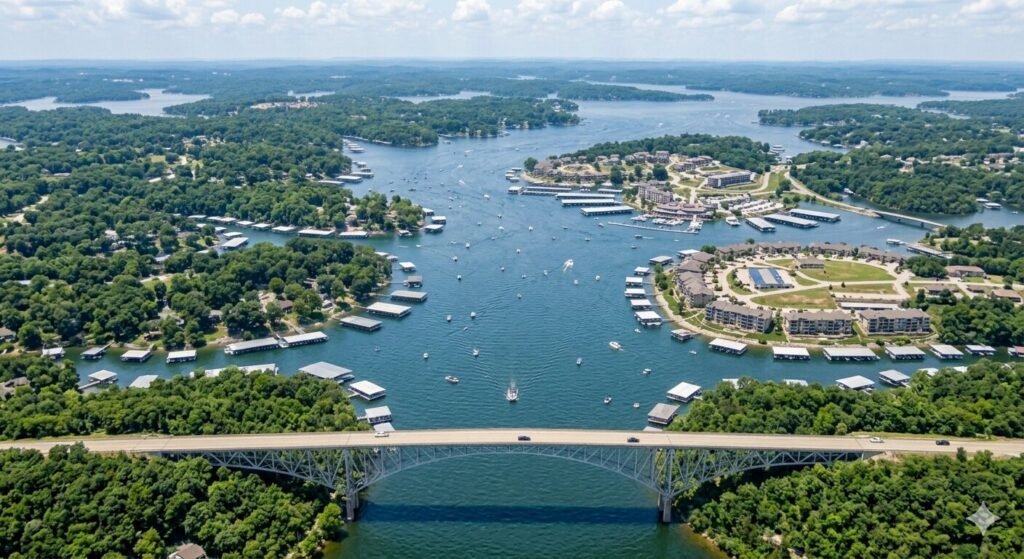
Aerial view of Lake of the Ozarks showing the main channel and branching arms from above
Guides

Understanding the Arms of Lake of the Ozarks for Boaters

The Lake of the Ozarks is not your typical lake. It does not sit in a simple oval or rectangle like most inland reservoirs. It winds, twists, and branches across central Missouri in a shape so serpentine that locals gave it a fitting nickname, the Magic Dragon. With over 1,150 miles of shoreline and a surface area of roughly 54,000 acres, this is one of the largest man-made lakes in the entire United States. For first-time visitors and even returning boaters who have only explored part of the lake, understanding how it is laid out makes a huge difference. The lake is organized around a central spine called the main channel, and branching off from that spine are several distinct arms, each with its own character, its own mile marker system, and its own appeal. This guide breaks down every arm of the Lake of the Ozarks so you can plan smarter trips, navigate with confidence, and get the most out of every day on the water. How the Lake Is Structured and Why the Arms Matter Lake of the Ozarks was created in 1931 when Bagnell Dam was built across the Osage River in central Missouri. The dam flooded the entire Osage River valley along with several of its tributaries, and those flooded tributary valleys became the arms of the lake you see today. The main channel follows the original path of the Osage River, and the arms follow the paths of the rivers and creeks that once fed into it. The main channel, known as the Osage Arm, runs approximately 92 miles from Bagnell Dam at its northeastern end all the way to Truman Dam near Warsaw at the western end. This is the backbone of the entire lake. Every arm branches off from this central spine. The four primary arms are the Gravois Arm, the Grand Glaize Arm, the Big Niangua Arm, and the Little Niangua Arm. Each one was formed by a different tributary feeding into the original Osage River. The reason this structure matters so much for boaters is simple. Each arm has its own mile marker system that starts at zero where the arm meets the main channel. So when you hear someone say they are at the 6 Mile Marker on the Gravois Arm, that means they are 6 miles up the Gravois from where it connects to the main channel. Without understanding which arm someone is on, a mile marker number means very little on a lake this large and complex. Every marina, restaurant, resort, vacation rental, and waterfront business on the lake uses this combined system of main channel markers and arm markers to communicate location. Learning to read it is the single most important navigation skill you can develop before your first day on the water. The Main Channel | The Osage Arm The Osage Arm is the primary artery of the entire lake. It is the widest, longest, and most traveled section of water at Lake of the Ozarks. Mile Marker 0 begins at Bagnell Dam and the numbers increase as you travel south and west along this channel. The most developed, most visited, and most active stretch of the entire lake runs from approximately Mile Marker 0 to Mile Marker 25. This lower section of the main channel is where you will find the Bagnell Dam Strip, the cities of Lake Ozark and Osage Beach, the highest concentration of waterfront restaurants and bars, the majority of marinas and fuel docks, and many of the lake’s most famous events including the Lake of the Ozarks Shootout powerboat races. The Horseshoe Bend peninsula wraps around the channel between roughly Mile Markers 3 and 10. The Osage Beach area sits between approximately Mile Markers 14 and 21, and this stretch is considered the commercial and social heart of the entire lake. As you travel west beyond Mile Marker 25 and further up the Osage Arm, the lake gradually becomes quieter and less developed. The shoreline transitions from dense resort and residential development into more rural, forested terrain. By the time you reach Mile Markers 40 to 60 near the Hurricane Deck community and beyond, the lake has a noticeably different feeling. It is wider in some sections, quieter overall, and the boat traffic thins significantly compared to the busy lower channel. This upper section is excellent for fishing, quiet cruising, and exploring the more natural, undisturbed side of Lake of the Ozarks. The Grand Glaize Arm The Grand Glaize Arm is the most famous and most visited of all the lake’s tributary arms. It branches off the main Osage channel at approximately Mile Marker 19, right where the Grand Glaize Bridge carries US Highway 54 over the water in Osage Beach. When you pass under that bridge heading southeast, you have entered the Grand Glaize Arm. The arm runs approximately 16 miles from its junction with the main channel before narrowing into a stream near the upper end. This arm is home to one of the most iconic destinations on the entire lake. Party Cove, officially known as Anderson Hollow Cove, is located within Lake of the Ozarks State Park at approximately the 4 Mile Marker of the Grand Glaize Arm. On peak summer weekends, over 3,000 boats gather here in what is widely described as the largest floating party in the country. It is a cultural institution of the lake and a bucket list destination for boaters from across the Midwest. Beyond Party Cove, the Grand Glaize Arm is known for its calm, protected waters that are particularly well suited to tubing, water skiing, and relaxed anchoring in coves. The arm is also home to two of the lake’s only public swimming beaches, both located within Lake of the Ozarks State Park. Public Beach 1 sits at approximately the 12 Mile Marker on the Grand Glaize Arm, and Grand Glaize Beach is nearby. Both offer sandy shoreline swimming in a park setting, a rare find on a lake where

Hurricane Deck Bridge carrying Missouri Route 5 over the Osage Arm of Lake of the Ozarks
Guides

How to Cross the Hurricane Deck Bridge on a Tall Yacht at Lake of the Ozarks

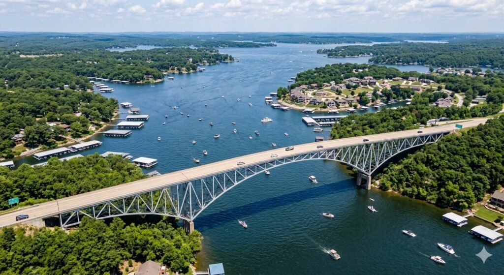
Lake of the Ozarks is a massive lake. Its main channel stretches 92 miles from Bagnell Dam all the way to the western end near Warsaw. Most casual boaters and yacht renters spend their time in the lower portion of the lake, roughly between Mile Marker 0 and Mile Marker 30. But if you are planning to push further west toward the Hurricane Deck area, there is one question every tall vessel operator needs to answer before heading out. Can your yacht clear the Hurricane Deck Bridge? This is not a question most boaters think about on a typical lake day. Standard pontoon boats and mid-size rental vessels have no issue. But tall yachts, flybridge cruisers, large houseboats, and vessels with elevated upper decks face a real consideration at this bridge. Getting this wrong is not just an inconvenience. It can cause serious damage to your vessel and create a dangerous situation on the water. This guide covers everything you need to know. What the Hurricane Deck Bridge is, why it matters for tall vessels, how to determine if your yacht can safely pass, and what your options are if it cannot. What Is the Hurricane Deck Bridge and Where Is It The Hurricane Deck Bridge carries Missouri Route 5 across the Osage Arm of Lake of the Ozarks. It is located in the unincorporated community of Hurricane Deck in Camden County, roughly in the mid-to-upper section of the main channel, connecting the communities of Laurie and Camdenton on either side of the lake. The original Hurricane Deck Bridge was built in 1936 and was one of the most iconic structures on the entire lake. It was an upside-down truss design, meaning the support structure sat below the road deck rather than above it. This gave drivers spectacular views of the lake as they crossed, and it became one of the most photographed and distinctive features on the water for decades. That original bridge was eventually replaced. The new Hurricane Deck Bridge was completed in 2014, built by the Missouri Department of Transportation at a cost of approximately 32 million dollars. The replacement is a modern plate girder bridge, 2,260 feet long, supported on large diameter drilled shaft foundations that reach down through 85 feet of water into bedrock. It is built to carry traffic for the next 100 years. The new structure has two 12-foot lanes and seven-foot shoulders, making it wider and safer than its predecessor. But the plate girder design sits lower over the water in certain areas compared to the tall clearance of the old upward-arching truss design, which is exactly why tall vessel operators need to pay attention. Why Bridge Clearance Matters for Tall Yachts Bridge clearance is the vertical distance between the water surface and the lowest point of the bridge structure above. For most recreational boats, this number is irrelevant. A standard pontoon rental sits low and passes comfortably under almost any bridge on the lake. But as vessel size increases, so does the height of the structure above the waterline. A typical center console or pontoon boat might stand 6 to 9 feet above the water at its highest point. A flybridge yacht or cruiser can reach 14 to 18 feet or more above the waterline when you account for the upper helm station, radar arch, antennas, and any hardtop or canopy structure. Large houseboats with second-floor decks can be even taller. These vessels require significantly more vertical clearance to pass safely under a bridge without contact. On Lake of the Ozarks specifically, bridge clearance information is not officially published in a centralized or easily accessible format the way it is for coastal or federally regulated waterways. The Army Corps of Engineers and standard marine chart apps like Navionics do not consistently list bridge clearance heights for the bridges on this lake. This makes it the operator’s responsibility to research the specific bridge before approaching it in a tall vessel. Arriving at a bridge and discovering mid-approach that your yacht will not fit is one of the most preventable problems in boating, yet it happens every season somewhere on this lake. How to Know if Your Yacht Can Clear the Hurricane Deck Bridge The key step before attempting any bridge crossing in a tall yacht is knowing your vessel’s air draft. Air draft is the total height of your boat measured from the waterline to the highest fixed point on the vessel. This includes radar arches, antennas, hardtops, flybridge railings, and any other structure that cannot be lowered or removed. If you are renting a yacht, your rental company should be able to tell you the air draft of the specific vessel you are booking. Once you know your vessel’s height, the next step is finding the actual clearance at the Hurricane Deck Bridge. Because this information is not officially published for recreational boaters on Lake of the Ozarks, you need to go directly to the best local sources. The most reliable approach is to contact MoDOT (Missouri Department of Transportation) directly and ask for the vertical clearance data for the Highway 5 Hurricane Deck Bridge over the Osage Arm. MoDOT has engineering records for the bridge and can provide this measurement. You can also contact the Camden County office or local marina operators in the Hurricane Deck and Sunrise Beach area who have practical, firsthand knowledge of what has and has not passed safely under that bridge. Additionally, lake level matters. Lake of the Ozarks operates at a normal pool elevation of 660 feet above mean sea level, and the lake rarely varies by more than 5 feet in either direction. When lake levels are higher than normal pool, there is less clearance under every bridge on the lake. When levels are below normal pool, clearance increases. If you are planning a tall vessel trip past Hurricane Deck, check the current lake level through Ameren Missouri’s website before your departure. A difference of even two to three feet in lake

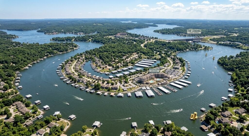
Aerial view of Horseshoe Bend peninsula on Lake of the Ozarks on a sunny summer day
Guides

Where Is Horseshoe Bend and Where Is Party Cove

Before you can plan the route, you need to know exactly where both destinations sit on the lake. Lake of the Ozarks uses a mile marker system that starts at Mile Marker 0 at Bagnell Dam and increases as you travel south and west along the main Osage channel. This system is how every boater, marina, restaurant, and local business on the lake communicates location, and knowing it makes navigation on this massive lake far easier. Horseshoe Bend is a large, seven-mile-long peninsula that wraps around a bend in the main channel, sitting between roughly Mile Marker 3 and Mile Marker 10 on the main channel. It gets its name from the horseshoe-like shape the lake forms as it curves around this stretch of land. The peninsula is dense with resorts, condos, restaurants, private homes, and marinas. Its position on the main channel means it is one of the most active and accessible areas on the entire lake. The Community Bridge connects Horseshoe Bend with Shawnee Bend on the other side of the water, and the area is only minutes from both Lake Ozark and Osage Beach by road or boat. Party Cove, officially known as Anderson Hollow Cove, sits within the boundaries of Lake of the Ozarks State Park on the Grand Glaize Arm of the lake. Its exact location is approximately the 4 Mile Marker of the Grand Glaize Arm. To reach Party Cove from the main channel, you pass under the Grand Glaize Bridge at the 19 Mile Marker on the main channel, then turn right and travel approximately 4 miles up the Grand Glaize Arm to reach Anderson Hollow Cove. Party Cove has had a few different locations over the decades, but its current home in the state park is where tens of thousands of boaters gather every summer weekend. The Distance by Boat from Horseshoe Bend to Party Cove Now for the key number everyone wants to know. The total distance by boat from Horseshoe Bend to Party Cove is approximately 20 to 26 miles, depending on exactly where you launch from within the Horseshoe Bend area and where you anchor at Party Cove. Here is how that distance breaks down. If you depart from the southern end of Horseshoe Bend near Mile Marker 10, you travel south along the main channel for roughly 9 miles to reach the Grand Glaize Bridge at Mile Marker 19. From there, you turn right and head up the Grand Glaize Arm for another 4 miles to reach Anderson Hollow Cove. That puts you at approximately 13 miles total from the southern tip of Horseshoe Bend. If you are launching from the northern end of Horseshoe Bend near Mile Marker 3, the math changes. You first travel south along the main channel for about 16 miles to reach the Grand Glaize Bridge at MM 19, and then 4 more miles up the arm to Party Cove. That puts the total closer to 20 miles from the northern end of the peninsula. The most common launching point for visitors at Horseshoe Bend is the mid-peninsula range, around Mile Markers 5 to 7. From there, the total water distance to Party Cove works out to roughly 16 to 18 miles. This is a very manageable trip for any boat or yacht, and it gives you a scenic run along one of the busiest and most entertaining stretches of the entire lake before turning into the calmer, more sheltered water of the Grand Glaize Arm. How Long Does the Boat Trip Take Travel time between Horseshoe Bend and Party Cove depends on your boat type, the speed you are comfortable cruising at, and how busy the main channel is on the day you go. On a clear weekday morning with moderate traffic, the trip takes between 40 minutes and one hour at a comfortable cruising pace of 20 to 25 mph. On a peak summer Saturday when the main channel between Horseshoe Bend and the Grand Glaize Bridge is packed with boats, expect closer to 60 to 90 minutes, particularly if you hit no wake zones around marinas and docks along the way. A helpful way to think about travel time on this lake is to use a simple formula. Take your distance in miles, divide it by your average speed, and multiply by 60 to get minutes. For a 17 mile trip at an average of 20 mph accounting for no wake zones and light traffic, you are looking at just over 50 minutes of actual boat time. Add in time to top off fuel, navigate a busy section of channel, and find your spot to anchor at Party Cove, and you have a total departure-to-arrival window of about one to one and a half hours. It is always worth leaving earlier than you think you need to. Party Cove fills up fast on summer weekends, and the best anchoring spots go quickly. Heading out by mid-morning gives you the advantage of lighter channel traffic on the way and a better position when you arrive at the cove. The Best Route to Follow by Water The route from Horseshoe Bend to Party Cove is straightforward once you know what to look for. You do not need to navigate through any confusing side channels or unmarked areas. The whole trip follows well-traveled, clearly marked water the entire way. You begin by heading south along the main Osage channel. If you are departing from the northern tip of Horseshoe Bend near Mile Markers 3 to 5, you will be passing through some of the busiest boat traffic on the lake almost immediately. This section near Lake Ozark city is packed with marinas, docks, waterfront restaurants, and private slips, so respecting idle speed rules within 100 feet of docks and anchored vessels is important here. Take it slow through congested areas and keep your eye on other boats. As you continue south past Mile Marker 10 and into the Mile Marker 10 to

Aerial view of Bagnell Dam and Lake of the Ozarks main channel on a sunny summer day
Guides

How to Get from Bagnell Dam to Osage Beach by Water

One of the best things about the Lake of the Ozarks is that you can experience almost everything it offers without ever leaving the water. The drive between Bagnell Dam and Osage Beach takes only a few minutes by car. But by boat, that same stretch becomes a completely different experience. You get to pass through the heart of the lake, watch the shoreline open up, and enjoy every mile of one of Missouri’s most iconic waterways. If you are planning a yacht rental at Lake Ozark and want to make the most of your time on the water, this route is one you need to know. This guide covers everything, from understanding the mile marker system to travel time, what you will see along the way, and tips to keep your trip smooth from start to finish. Understanding the Lake of the Ozarks Before You Cast Off Before you start plotting your route, it helps to understand how this lake is laid out. Lake of the Ozarks is a large reservoir created by impounding the Osage River. The main channel of the Osage Arm stretches 92 miles from one end to the other, and the lake has roughly 1,150 miles of shoreline in total. That is a massive body of water, and getting your bearings before you leave the dock makes everything easier. The lake is long and winding in shape, with several arms branching off the main channel. These include the Gravois Arm, the Grand Glaize Arm, and the Niangua arms to the southwest. For the Bagnell Dam to Osage Beach route, you will be traveling primarily along the main Osage channel, which is the central spine of the entire lake. Bagnell Dam sits at the northeastern end of the lake, where the Osage River is impounded. The city of Osage Beach sits where the lake’s southeastern arm joins the main channel. Knowing this positioning gives you a clear mental picture of the route before you even touch the throttle. The Mile Marker System | Your Best Friend on the Water If you are new to Lake of the Ozarks, the mile marker system is the single most important thing to understand. Unlike navigating by street signs or landmarks, this lake uses a numbered reference system along the shoreline that tells every boater exactly where they are at any given moment. Mile Marker 0 begins at Bagnell Dam, and markers increase as you travel southward up the main Osage arm. Most marinas, restaurants, and vacation rentals identify their location by mile marker. So when a local tells you that a restaurant is at the 18 mile marker, they mean it is 18 miles along the main channel from Bagnell Dam. On the lake maps, you will notice a series of numbers printed along the waterways. These numbers represent lake mile markers and are used to communicate a location with lake access. When you see a number without any arm designation, it refers to a main channel location. Each arm of the lake has its own separate mile marker system that starts at zero where the arm meets the main channel. The Osage Beach area sits roughly between mile markers 14 and 21 on the main channel. This stretch is considered one of the best areas for visitors because it offers central access to dining, shopping, attractions, and the lake’s main channel. That means your water journey from Bagnell Dam to Osage Beach covers approximately 14 to 20 miles of open lake water, depending on exactly where you plan to dock in the Osage Beach area. The Water Route from Bagnell Dam to Osage Beach Starting your trip at or near Bagnell Dam puts you at Mile Marker 0, the very beginning of the lake’s main channel. From here, you head south along the Osage arm. The channel is wide and well marked in this section. The lake opens up quickly once you clear the dam area, and you will feel the full scale of this reservoir almost immediately. As you leave the dam area, the first several miles take you through the Lake Ozark city zone. The area around Osage Beach and Lake Ozark, roughly between mile markers 10 and 20, is the most developed stretch of the lake. This is where you will find the Bagnell Dam Strip, the majority of the resorts, and the highest concentration of restaurants and shops. This is also where boat traffic picks up significantly on weekends, so keeping your speed sensible and watching for wakes is important during this stretch. Between mile markers 7 and 10, you will begin passing several well-known marinas and fuel docks. There are gas docks near the 7 mile marker area, which are great for a quick fill-up if you are boating near the Bagnell Dam area, and at around mile marker 7.5, there is an upscale marina offering fuel, pump-out services, and a full-service resort if you want to dock and dine. This section of the route is busy but extremely well served with facilities. Continuing south along the main channel, you will pass through some of the most scenic and activity-filled water on the entire lake. Coves branch off on both sides. Houseboats and pontoons dot the shoreline. Private docks with boats tied up signal the dense residential and resort development that makes this corridor so lively. By the time you reach the 14 to 21 mile marker range, you have arrived in Osage Beach territory. The Grand Glaize arm branches off to your southeast in this section, and that is where several key docking spots and waterfront establishments are located. How Long Does the Boat Trip Take? Travel time on this route depends on a few factors. The most important ones are your speed, the amount of boat traffic on the water, and how many no wake zones you encounter along the way. When thinking about travel by boat, a simple formula helps with planning: time in minutes equals distance in miles

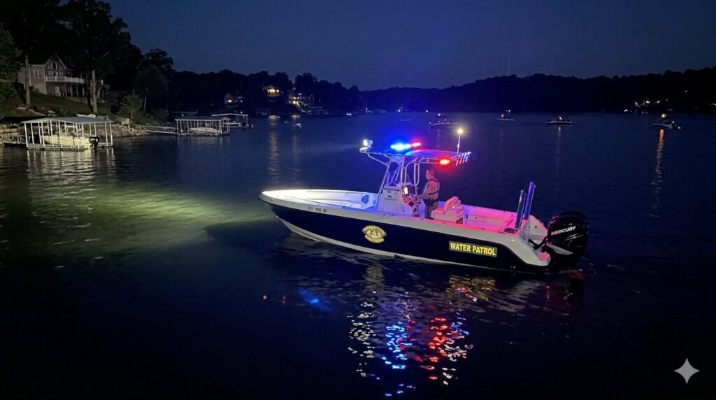
Missouri Water Patrol boat on Lake of the Ozarks during nighttime patrol
Guides

What Is the Speed Limit for Boats on Lake Ozark at Night?

The Lake of the Ozarks is one of the most popular boating destinations in the entire Midwest. Thousands of people come here every summer to enjoy the water. And while most of the fun happens during the day, plenty of boaters head out after sunset too. Sunset cruises, evening yacht trips, and night fishing are all huge draws at this lake. But once the sun goes down, the rules change. If you are planning a nighttime boat trip or renting a yacht at Lake Ozark after dark, there is one question you need to answer first. What is the speed limit for boats on Lake Ozark at night? This guide covers everything you need to know. The exact speed limit, when it kicks in, the no wake zones, navigation light requirements, and key safety tips for boating after dark. The Night time Boat Speed Limit at Lake of the Ozarks The speed limit for boats on Lake of the Ozarks at night is 30 mph. This nighttime limit begins half an hour after sunset and runs through one hour before sunrise. Fun Lake That window matters. It is not simply “after dark.” The law is very specific about timing. The limit starts one half hour after sunset and ends one hour before sunrise. If you are on the water during that window, you must stay at or below 30 mph. Ozark law center During the daytime, Missouri does not enforce a single fixed speed limit across the entire lake. Daytime boating has no specific speed limit, but operators must maintain a safe speed at all times. The nighttime rule is different. It is a hard legal cap, and the Missouri State Highway Patrol Water Patrol Division enforces it actively. Worlds best boat cover Even though 30 mph is the legal maximum at night, depending on visibility conditions, it may be wise for boaters to travel much slower than the posted limit. The lake can be dark, crowded, and unpredictable after sunset. Slowing down is always the smarter move. Why Does the Nighttime Speed Limit Exist? This rule is not arbitrary. It exists because nighttime boating carries real risks that simply do not exist during the day. When you are out on the water after dark, your depth perception drops significantly. Objects on the water are harder to judge from a distance. Other boats are harder to spot. Floating debris, docks, and shallow areas become much more difficult to see in time to react safely. Add the reflection of dock lights, shoreline lights, and other vessels, and it becomes easy to misread your surroundings. The Missouri Highway Patrol recognizes the inherent dangers of night boating, which is why they enforce the 30 mph speed limit on the Lake of the Ozarks. But speed is far from the only factor that impacts the dangers of night boating. Many accidents happen not because of excessive speed alone, but because boaters lack the right equipment or do not follow proper lighting rules. Horn Law The 30 mph limit gives boaters a reasonable window to react. It keeps wakes smaller and reduces the impact of any sudden encounter with another vessel or hazard. It is designed to protect everyone on the lake, including you and your passengers. No Wake Zones and Idle Speed Rules at Lake Ozark The nighttime speed limit is not the only rule you need to know. There are also strict no wake zone and idle speed rules that apply at all hours, day and night. It is illegal to operate a boat or personal watercraft at speeds greater than idle speed within 100 feet of a dock, occupied anchored vessel, or buoyed restricted area. This rule does not change at night. If anything, it becomes more important after dark because visibility is lower and it is harder to judge your distance from nearby structures. Fun Lake Missouri law states that vessels must not be operated within 100 feet of any dock, pier, occupied anchored boat, or buoyed restricted area at a speed exceeding slow no wake speed. Violating this rule is an infraction and can result in a fine. Missouri Revisor of Statutes Slow no wake speed means you are moving forward, but your vessel is not producing a significant wake. Think of it as barely above idle. This is especially important around marinas, yacht docks, and rental facilities where other boats are tied up close together. If you are renting a yacht at Lake Ozark, your rental company will walk you through the specific no wake zones near their facility. Pay attention to this briefing. These zones are clearly marked with buoys, but at night they can be easy to miss if you are not looking for them. Navigation Light Rules for Night Boating at Lake Ozark Beyond speed, navigation lights are one of the most critical legal requirements for nighttime boating. This is where many boaters get cited by the Water Patrol. Missouri state law requires boat operators to display the required navigation lights between sunset and sunrise. Generally, vessels are required to display a red light on the port side and a green light on the starboard side. These lights should be visible from at least one mile away on a dark, clear night. Lake Expo These lights serve a very specific purpose. They tell other boaters where you are and which direction you are traveling. Without them, a fast moving yacht becomes nearly invisible on a dark lake. That is an extremely dangerous situation, especially on a busy summer weekend when dozens of boats may be out after dark. It is illegal to display spotlights or docking lights continuously on the water. However, these lights may be used briefly to identify hazards. So while you can flash a spotlight to check for something in the water, you cannot leave it running as a substitute for proper navigation lights. Lake Expo Before any nighttime yacht trip, check every navigation light on the vessel. Make sure they are

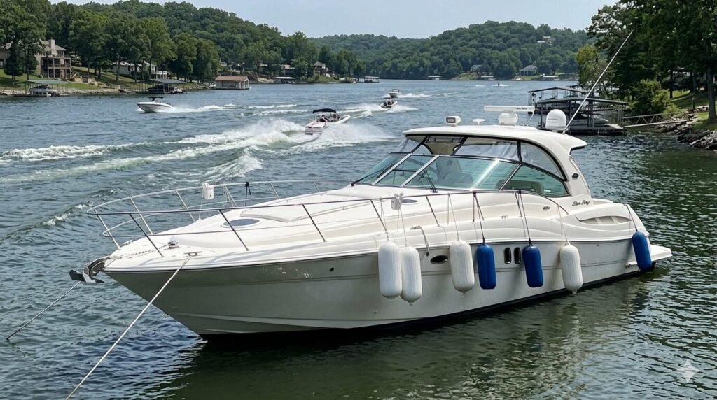
Fenders deployed on both sides of an anchored luxury yacht protecting against wake damage at Lake of the Ozarks Missouri
Guides

How to Avoid Wake Damage When Anchoring a Yacht at Lake of the Ozarks

Lake of the Ozarks is one of the busiest recreational lakes in the United States. On a peak summer weekend, thousands of vessels are on the water simultaneously. High-powered ski boats, wake boats, pontoons, jet skis, and luxury yachts all share the same channel. Every one of those vessels creates wake. That wake travels across the lake in every direction and eventually reaches every anchored vessel on the water. Wake damage to an anchored yacht is a real concern on Lake of the Ozarks. It ranges from minor inconveniences like spilled drinks and knocked-over items to serious problems like hull-to-hull contact with other anchored vessels, anchor drag, and in worst-case scenarios, structural damage from repeated high-energy wake impacts. The good news is that wake damage when anchoring a yacht at Lake of the Ozarks is almost entirely preventable. The right cove selection, the right anchor setup, the right fender deployment, and the right situational awareness together create a protected anchoring situation that handles even the busiest lake traffic without incident. This guide covers every one of those elements in depth. Understanding Wake Behavior at Lake of the Ozarks Before you can protect your anchored vessel from wake, you need to understand how wake behaves on this specific lake. Lake of the Ozarks wake patterns are different from those on a smaller lake or on open coastal water. The main channel at Lake of the Ozarks generates the highest volume and most varied wake patterns on the lake. Every vessel passing through the main channel creates a wake that radiates outward in both directions from the vessel’s path. A large wake boat at speed generates waves that can travel hundreds of feet from the source. A fast-moving pontoon creates a V-shaped wake that fans out across the full width of the channel. When multiple vessels are operating simultaneously in the same channel section, their wakes intersect and create a confused cross-chop pattern that hits anchored vessels from multiple directions at unpredictable intervals. Coves off the main channel receive wake in a modified form. The cove entrance acts as a filter. Wide cove entrances with direct exposure to the main channel receive nearly the full energy of passing wakes. Narrow cove entrances with offset geometry relative to the main channel significantly reduce the wake energy that penetrates into the cove interior. The shape, orientation, and depth of the cove entrance determine how much of the main channel wake energy reaches an anchored vessel inside. Wake boats and large powered yachts generate the most damaging wake on Lake of the Ozarks. These vessels displace large amounts of water at speed and create steep-faced waves that retain their energy over significant distances. A wake boat at full speed 300 feet away from your anchored vessel can generate waves large enough to cause significant rolling motion and snap load on your anchor rode if you are not properly prepared. Reflected wake is a phenomenon that catches many anchored boaters off guard on Lake of the Ozarks. When a wave hits a bluff face, a concrete seawall, or a steep shoreline, it does not simply stop. It reflects back across the water at an angle. An anchored vessel that is positioned between a passing wake source on the main channel and a reflective shoreline behind it receives wake energy from two directions simultaneously. Understanding the reflection geometry of your anchoring position helps you anticipate this effect and position to minimize it. Cumulative wake loading is the sustained stress that multiple waves impose on your anchor system over time. A single large wake is manageable if your anchor is set correctly. Hours of repeated wake impacts, each pulling and releasing the anchor rode, create a cumulative loading effect that can work an improperly set anchor free of the bottom over time. This is how anchors drag without any single dramatic event triggering the failure. The anchor simply works loose gradually under repeated loading cycles. Cove Selection | Your First Line of Defense Against Wake Damage The single most effective way to protect an anchored yacht from wake damage at Lake of the Ozarks is choosing the right cove in the first place. A well-chosen anchorage dramatically reduces the wake energy your vessel is exposed to before you deploy a single fender. Choose coves with narrow or offset entrances. A cove whose entrance is narrow relative to its interior provides natural attenuation of incoming wake. The wake energy that passes through a narrow entrance spreads across a larger area inside the cove, reducing its height and energy by the time it reaches an anchored vessel. An offset entrance, where the cove opening faces a direction other than directly toward the main channel, provides even more protection because passing wakes must bend around the shoreline geometry to enter the cove at all. Prioritize bluff-lined coves for maximum protection. The rock bluff formations in the Hurricane Deck area and throughout the upper mid-lake section between Mile Marker 32 and Mile Marker 42 create some of the most naturally protected anchorages on the entire lake. Bluff walls deflect wind and reduce the fetch that allows waves to build inside the cove. They also absorb rather than reflect wake energy in a different way than smooth vertical surfaces. The calm water typically found in bluff coves on Lake of the Ozarks is not accidental. It is the result of excellent natural protection that the geological features provide. Put distance between your anchorage and the main channel. The further your anchored position is from the main channel, the more energy dissipation occurs before wake reaches you. Even 200 to 300 feet of additional distance from the cove entrance makes a measurable difference in the wave height and energy experienced at the anchoring position. In a well-shaped cove, positioning your anchor in the far interior rather than near the entrance reduces your wake exposure significantly. Avoid coves with wide open entrances facing the busiest traffic sections. A cove that opens directly toward a

Scroll to Top